NB: Please note, I don't usually provide personal forecasts via email although exceptions are made for some community groups and all of my neighbours within a stones throw. Please contact The Weather Company for professional weather advice. Be careful though, its expensive!
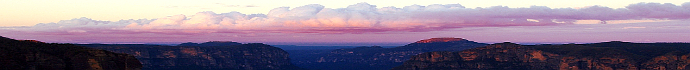
22-12-11, Thursday 9am: The amazing cold we've experienced this summer continues with December average maximum temps currently 6.1C below average, based on the long term averages from the Katoomba site. December average minimums are 3C below average. Even though it has felt constantly wet, the Katoomba recorded rainfall so far for December is only a little above the average at 140.6mm (average 121.8mm). Mt Boyce AWS has currently recorded 93mm and the average is 78.1mm for December. Its just that we've had constant drizzle, mist or rain from easterly winds, rather than the typical heavy bursts from storms then back to sunshine again, which is the more usual experience in summer.
Currently our average maximum temps for December are colder than those of November and October this year and nearly as cold as September. That is a very rare occurence. Still, there is more than a week to go of December, so it may still turn out slightly warmer than October. There are signs of some warmth coming later in this month and into January, so lets hope its not just a sign but a reality as we move into the new year.
Its not just the Blue Mountains that has seen summer chill, Sydney is going through one of its coldest Decembers in recorded history and it may even turn out as the coldest December ever, down in the city. Meanwhile, over in Western Australia, it appears Roebourne has recorded the states hottest ever day, yesterday, at 49C. Still to be confirmed.
12-12-11, Monday, 1pm: 16mm in my gauge for the 24 hours to 9am today after that storm approached from the south yesterday, not much lightning from it though. That's 57.5mm for December, so far, from my gauge. We could still get decent showers from today's low off the coast but the chances are lessening as the day goes on. Check out this photo from yesterday's storm action that brought around 125mm, south of Bethungra in NSW. Click here.
8-12-11, Thursday 8am: The cold start to summer continues with Mt Boyce AWS showing our current average maximum for December is running at more than 7C below average. Minimums are currently around 6C below the average. Further north in Brisbane, it looks like they may have had their coldest December day in 123 years at 19.1C, according to Weatherzone. In the short term, this chilly weather looks set to continue. Don't worry, we will get warmth at some point, its just a little hard to believe that, when you have the heater on and are wearing two jumpers in summer!
5-12-11, Monday 5pm: A chilly start to summer! We recorded our coldest ever December minimum this morning with 2C at Mt Boyce. There was a good frost at Sunny Corner too where it reached 2.2C. The Katoomba minimum of 2C looks like it is an all-time record for December in seventy five years of records. This is yet to be confirmed. Sydney is also set to achieve its coolest summer in fifty one years over the next few days, according to Weatherzone. Stay tuned.
5-12-11, Monday 9am: November was a wet month, thanks to the trough system we had at the end of the month. It would have been a below average month if not for that strong system. Mt Boyce AWS recorded 173.8mm for the month, which is around 70mm more than the average. Average maximum and minimum temps were 21.3C and 11.5C, which is +1.7C and +2C above the average, respectively. Katoomba recorded 180.8mm for the month, the average being 107mm. Katoomba's maximum and minimum averages for the month were 21.8C and 12.1C, which is +1.7C and +2.4C above the long term average, respectively.
30-11-11, Wednesday 10am: Check out some of Greg Sorenson's fantastic lightning photos from yesterday's action in NSW. Click here.
It pretty much played out as expected on Tuesday, some isolated storms up this way but nothing much for the Blue Mountains. That should change today with a higher chance of storms moving over the Blue Mountains. I'd rate it a 60% to 70% chance. Its possible (about a 15% chance) they could be severe storms (hail 2cm or larger, damaging winds, flash flooding) although the most likely outcome is light to moderate showers with the possibility of thunder/lightning. Keep an eye on the warnings and radar, in case a rogue storm or two comes this way.
29-11-11, Tuesday 10am: Some more nice sunshine today although winds are notably fresher. This wind shear may help storms make the passage from further inland to the Blue Mountains today although the weather balloon soundings from Wagga and Sydney show a lack of mid and lower level moisture. So, it should cloud over by this afternoon and winds could freshen but I would only rate it a 30% chance of significant storms. Still, the potential is there for hail or isolated flash flooding so be careful.
28-11-11, Monday midday: Some lovely sunshine today, giving us a welcome respite from all of that rain. There is another approaching trough (not unusual for spring/summer) that should reach us by later tomorrow or into Wednesday. Its unlikely to produce anything like the last event but there could be some notable storms and/or showers at times across the central tablelands. Tassie should also see snow by the first day of summer atop Mt Wellington, with the front associated with this trough.
26-11-11, Saturday 8am: NB: Check out the video of a quite heavy Bridal Veil Falls in the photos link above. Another 47.5mm for the 23 hours to 8am today, that's 134.2mm for this event so far from my gauge with lighter showers still falling. The IR sat loop shows weakening convective activity to our NW now and you can also see this reflected on radar. There will be a gradual clearing pattern into this afternoon although some showers may still linger.
25-11-11, Friday 11am: Another 21.2mm for the 24 hours to 9am today, that's 86.7mm for this event so far from my gauge - very impressive. The IR sat loop shows significant convective development to our NW and you can also see this reflected on radar. There is potential for quite heavy rain this afternoon but exactly where this occurs is the question. Take all the usual precautions if you are driving this afternoon.
The BoM has included the Central Tablelands forecast district as a risk for flash flooding, so the potential is there for all towns across this district. It should gradually improve by later on Saturday with Sunday and Monday looking mostly dry at this stage. Storms or showers could still occur next week with the presence of a new trough.
24-11-11, Thursday 1pm: Another 15.5mm for the 24 hours to 9am today. It should ease a bit today although Friday could again bring moderately heavy showers as an upper trough and surface low develop - we will have to see how this setup develops overnight tonight before outcomes are clearer. It should gradually improve at this stage as we move into Saturday with temps getting warmer by Sunday and into the new week. Storms or showers could still occur next week with the presence of a new trough.
23-11-11, Wednesday 5pm: 50mm in my gauge to 9am this morning, for the preceeding twenty four hours. We've had more than 15mm since 9am as well. It should ease a bit tomorrow although Friday could again bring moderately heavy showers.
18-11-11, Friday 7pm: Some very warm weather on the way for Blue Mountains folk this weekend, it may even have a bit of that sultry feel to it as another trough approaches and injects moisture into the weekend setup. High twenties are on the cards for upper mountains folk and lower mountains dwellers will be sweating even more. Storms are about a 40% to 50% chance tomorrow and about a 60% chance on Sunday, going off tonights charts. Sunday shows a bit more potential for potent storms (possible hail, strong winds etc) but lets see how the models develop tomorrow.
17-11-11, Thursday 7am: 27.8mm in my gauge since 9am yesterday, which is a very good result. Blackheath was right in line with the SE edge of the trough yesterday and it reaped some handy dividends. No real sparkage though (ie: no storms) as the cloud cover for most of the day surpressed the electrical activity. Some okay potential for storms or showers today across the Blue Mountains and the Central Tablelands although this trough is gradually moving NE. Stearing winds, via the information from yesterday arvos Sydney weather balloon, are quite good at the 500hPa level, so this may drag some storms/showers over the Oberon Plateau and into the Blue Mountains later in the day. As always, storms/showers are isolated or scattered in nature, so not all areas will see activity. I may add more info if time permits.
16-11-11, Wednesday 10am: Some fairly good potential for storms or showers today across the Blue Mountains and the Central Tablelands in general. As usual, storms/showers are isolated or scattered in nature, so not all areas will see activity. The mid level winds are quite strong today so there is the potential for damaging winds in any localised storms. Moisture profiles on the weather balloon soundings are not great in our area but real-time storms this afternoon may improve on this scenario and produce some decent rainfall. Hail is not a high chance but it is still possible.
One problem, later today, might be the arrival of the moist, cooler south easterlies. This can inhibit convection or storm activity, so cloudiness and drizzle is also a possibility later today, especially across the Blue Mountains.
10-11-11, Thursday 9am: Just after I wrote the paragraph below I started to sense that the brisk westerlies of mid-morning yesterday might reduce our storm chances but didn't get a chance to update my thoughts. I'm not sure why this is the case but when the westerlies get going early on a potential storm day, they tend to reduce our storm chances, even when surface dew points are quite good. Perhaps this is because there is less directional wind shear (ie: lack of moist NE winds at the surface) feeding into the approaching trough, I am not sure. If you have any ideas, feel free to email me.
9-11-11, Wednesday 8am: 12.6mm in my gauge from the last two days of storms. Certainly unstable across NSW again today. Lifted indexes show ample potential for lightning, strong winds and heavy showers but generally less potential for hail, due to the high RH in the mid levels. I'd say the Blue Mountains has a 60 to 70% chance of storms later today.
Storms will be scattered or perhaps isolated at times, so not all areas will see activity. This is the usual course of events during storm outbreaks.
The weather balloon soundings for Sydney and Wagga certainly show it being somewhat murky in the mid levels of the atmosphere so there may not be a lot of lovely storm structure to view, if you like that kind of thing. Such a setup like this does tend to keep the larger hail away though, although more elevated areas on the NSW ranges could see hail.
Due to the fairly good mid level stearing winds and good instability, Sydney also has a reasonably good chance of seeing storms later today.
Don't park under gum trees this arvo and unplug your routers if you can, during peak storm activity later today/tonight. Make sure your gutters are cleared and loose items around the house/office are secured.
3-11-11, Thursday 9am: Mt Boyce for October came in at 7.3C for minimums, -0.4C below the average and 16.5C for maximums, -1.3C below the average. Katoomba had 7.7C for minimums, right on the average and 16.9C for maximums, 0.7C below the average. Katoomba rainfall of 91.8mm was very close to the long term average of 90.9mm and Mt Boyce October rainfall was 48.8mm, which was 20mm below the average.
25-10-11, Tuesday 10am: There is the potential for some decent storms this afternoon across the Blue Mountains with flash flooding possible. They look like they will be fairly fast moving storms too. Quite strong wind gusts are also possible with these storms. If you are without power (due to lightning or wind damage) you can call the weather warnings number above for the latest details.
16-10-11, Sunday 8am: Some respite from the dreaded drizzle for the Blue Mountains this week, it appears. Sure, drizzle/mist is much loved by gardeners up this way but we've had our share in recent weeks. Looks like some nice sunshine this week although a lingering trough might see some cloud or showers tomorrow.
13-10-11, Thursday 9am: Well, if you are bothered by the amount of chilly, cloudy days we've had in October, you are not alone. The Mt Boyce AWS is 3C below the average for minimums and 5C below the average for maximums. The longer terms sites are also showing below average trends with Katoomba showing average minimums for October at 5.2C, which is a 75 year record at this stage, although its still only mid month, so things will warm a little by month's end. Another long term site, Wellington, is showing average maximums for the the month so far at 19.2C, which is a 92 year record at this stage, -5.6C below the average. Bathurst is also showing average minimums at 3.2C, which is a record in 89 years of obs, at this stage.
7-10-11, Friday 1pm: There is a moderate chance of storms today in the Blue Mountains and a slight chance they could be severe, which by definition means flash flooding, winds over 90kph and large hail. The most likely outcome is some showers and/or lightning but it is possible things could become nastier under isolated cells in our region. As always in spring, stay tuned to the latest warnings.
28-9-11, Wednesday 8am: The Blue Mountains will see an increasing chance of rain today, possibly fairly heavy at times if you are under the best convective activity. By the time this event eases later tomorrow, we could see 15mm or more. There is a chance of a fair bit more than that if convection maximimises over the Blue Mountains although western and central areas of our state should do best. It will also get increasingly windy with winds gradually easing by the weekend. Stay away from those leaning gum trees in town. Sadly, I see too many cars parked under leaning trees, damaged by our wind storms in July.
25-9-11, Sunday midday: Quite cold upper level temperatures exist today across the Blue Mountains in the -24C range. That is why we are getting hail at times, even though it is quite chilly in town. Those cold uppers at 500hPa are forming the hail and the chilly surface temps are allowing it to survive as it falls to the ground. This moderate to heavy shower activity should ease overnight. Heading towards 30mm recorded in my gauge since the drizzle came in yesterday. The showers today have been moderately heavy at times.
20-9-11, Tuesday 3pm: Sad to see bushfires around Leura today. Looks like they were deliberately lit as well, going on current information. Fire at this time of year isn't always a portent for later in spring and summer. At this stage it is looking like another LaNina developing or perhaps even neutral conditions persisting into summer. So hot and dry isn't overly likely as we move into summer at the moment, rather humid and warm. We still need another month or so to confirm this though, so stay tuned.
6-9-11, Tuesday midday: We have an interesting, somewhat unpredictable weather system moving our way by Friday/Saturday which could bring good rain for the central tablelands and possibly snow too. Its a tricky system to call at present so we need to watch the forecasting models for another day or two for more clarity. We could see some quite strong winds with this system too, starting today with fresh winds but even stronger as we move towards Friday. I'll update in the Cold Outbreak News link above too, if snow looks like it will occur.
31-8-11, Wednesday 8am: Here is an interesting article on this years climate extremes and the impact of climate change from The Conversation Blog by Dr Blair Trewin. Blair has been around weather forums since the 1990s and from my point of view, is a very well respected and considered climatologist from the BoM. I've been interacting with him on these forums and following his posts since the aussie-weather list days in the mid nineties. I've also learn't a lot from him in the context of snow forecasting and understanding weather systems in general. You can view his article here.
No matter what your views on the causes of climate change may be, there is no doubt it is happening. I have to say that I am quite surprised that this winter didn't bring more snow and enduring cold fronts into August. With a quite persistent, negative Southern Annular Mode, the strongest solar minimum in almost a hundred years etc, I was feeling fairly confident of a good, snowy winter. It started off quite well but since mid July it has been a poor winter for fronts. The ski fields reflect this outcome, especially the lower resorts like Mt Selwyn.
20-8-11, Saturday 9am: A long time between drinks on this link as I've been busy doing updates on the winter page. We may have felt like this winter has been quite cold but looking at the longer term observation stations its been around average. Mt Boyce was 0.4C below the average for minimums for June and 0.1C below for July and -1.7C below average for maximums in June and -1C below for July. August is running well above average though with minimums +1.3 above the average and maximums +0.4C above. Its important to realise that the Mt Boyce AWS is a 'young' station, so the averages from this station are warmer than the long term stations, due to the warming climate since Mt Boyce AWS opened in the 1980s. So, in reality, its been even milder this winter than Mt Boyce AWS suggests.
Perhaps its felt colder this winter because of the amount of windy days and also because so many of our winters in the last decade or two have been so mild compared to earlier decades.
14-6-11, Tuesday 4pm: Starting to pack a real punch now, this weather system. The low and upper trough are combining nicely to bring heavy rain to the central NSW coast and moderate rain across the Blue Mountains. My home gauge is approaching 40mm since Sunday morning with a fair bit more to come, it would seem. Some models are showing that much rain again over the next thirty six hours but we will have to see how far south this system moves, before it moves away to the SE.
12-6-11, Sunday 4pm: After the burst of serious cold last week we are now into a burst of south easterly dampness and wind. We may see quite heavy rain here by mid week but this is unclear at present, depending on how the surface trough and upper trough develop. No real sunshine though until about Thursday or Friday at this stage.
12-6-11, Sunday 3pm: May monthly summaries showed that it was quite a cool month in Blackheath, with not much rain initially, followed by a big burst of rain at the end of the month. Our average minimum and maximum for the month was 4.3C and 12C respectively, which was -1.7C lower than the long term average for minumums and -1.4C below the long term average for maximum temps. Rainfall came in at 58.2mm which is just above the long term average of 53.3mm, thanks to the 41.4mm we had on the 31st. Katoomba had an astounding 122mm on the 31st, which was a 122 year record. Katoomba's min and max averages for the month were 4.9C and 13.C respectively, which is -1.2C below and 0.1C above the long term average.
1-6-11, Wednesday 11am: Another 33.8mm to 9am today after the 42.6mm yesterday, these figures are from my gauge. Mt Boyce had a total of 85.6mm over the last two days. That is impressive indeed from this surface trough and associated upper trough. Conditions should gradually improve today but still remain cloudy and possibly showery.
31-5-11, Tuesday 8am: After a pretty dry May and not much weather to talk about, mother nature has come back with a vengence late in the month. Mt Boyce has currently recorded 38.2mm for this event, in the last 22.5 hours. Today should be the worst day with conditions easing a touch tomorrow and improving again by Thursday. It wont be great weather by Thursday but it should be better than today. After that, we should see a gradual return of some frontal weather from the SW.
7-5-11, Saturday midday: A nice frost today if you were up early enough to see it. It was beautifully white at 6am and still some patches at 7am. Even though the official temp only dipped below 4C (my gauge recorded 3C), its important to remember that is the screen temperature which is taken at around 1.4M above the ground. The ground minimum would have been around -2C, at a guess. We had perfectly calm conditions by early this morning, so this allows the very coldest air created by radiative cooling to stay at grass/ground level and not mix in with the milder air slightly higher up. Also, on very calm, clear nights, the Mt Boyce AWS is often milder than most places in Blackheath as any cooling, overnight air (more dense/heavier) quickly sinks into the valley below, leaving milder air on the top of the escarpment.
1-5-11: 58.1mm from my gauge for April and 63mm from the Mt Boyce gauge. The Mt Boyce average for the month is 50.1mm, so thankfully the wet weather at the end of the month boosted our total. Monthly minimum temp average came in at 8C which is -0.5C below the long term average whilst maximum temp average came in at 15.1C, which is -2C below the long term average. The longer term records at Katoomba showed average maximums to be -1C below the one hundred year average at 15.6C and average minimums came in at 8.5C, which is -0.1C below the long term average.
19-4-11, Tuesday 1pm: There is some wonderful autumn colour around this year, even if its a bit more isolated, after the mild March. If you can find a better Japanese Maple than the one near the corner of Seiberi Crescent and Evans Lookout Rd, please take a photo and send it in!
9-4-11, Saturday 11am: The mild nights of late are keeping the snakes out around here. I just took the dog for a walk down our bushy track at the bottom of the street and trod on the tail of a huge black snake. I think it got just as frightened as me. NPWS tells me it was probably a big red belly. Biggest RB I've ever seen, it was at least 6 ft long and thicker than my forearm. Feasting on lots of frogs and rats, I'd guess.
3-4-11, Sunday 8am: Just to put a balance on the popular media's spin on climate change its been a particularly cold March for maximum temps in Australia. This from the BoM, 'Maximum temperatures nationally were the coldest on record with an anomaly of -2.19C. Most of Australia recorded below average mean maxima with parts of the north and south of the country recording their coldest March on record'. Of course, certain areas have experienced prolonged heat. Perth has seen record heat in March. There's no doubt it has been a gradually warming climate for decades now but sometimes the specifics of what is happening can get lost in brief, sensationalist stories.
3-4-11, Sunday 8am: 163.7mm from my gauge for March which is well above the Mt Boyce AWS average of 96.5mm. The Mt Boyce official gauge recorded 159.8mm for March. Katoomba recorded 222mm for March which was above their long term average (1886 to present) of 166.3mm. The average maximum temp for Mt Boyce came in at 19.3C which was -1.3C lower than the average. Average minimum temps came in at 12.1C which was 0.8C above the average, not surprising considering all of the rain that we had. Katoomba maximum averages came in at 19.7C (0.5C below average) with average minimums being 12.6C, which is 1.3C above the long term average.
For newcomers to the mountains, be aware that the Katoomba gauge has a much longer history of weather recording than Mt Boyce although its reliability is sometimes questioned. It has been moved numerous times over the years. The manual observers over the decades for the Katoomba site, have almost always been reliable but site changes do alter the records somewhat.
16-3-11, Wednesday 11am: I would say there is a 50% to 60% chance of storms across the upper mountains today. Stearing winds in the upper levels are moderately good today and instability is fairly high too. There is also a slighty drier atmosphere in the mid levels than previous days so hail is also a chance later today.
13-3-11, Sunday 6pm: Some more storms across the Blue Mountains again today. Yesterday afternoon's storms were more lightning active and brought a short, sharp 7.8mm in my gauge but this afternoon's storms had little lightning but intense rainfall. Blackheath had a strong storm from around 4:15pm to 4:40pm, when 27.2mm fell. Only a few specks of small hail fell and winds were mostly light. Lightning wasn't common until right at the end of the storm when a classic Flang (simultaneous flash and bang) struck right over town. The radar showed the storm concentrated on SE Blackheath and towards Medlow Bath, so the Mt Boyce gauge recorded notably less rainfall.
12-3-11, Saturday 9am: Some nice storms across the Blue Mountains late yesterday and into the evening. No hail observed in Blackheath thanks mainly to the saturated atmosphere from the lower to upper levels. Mt Boyce recorded 15.8mm during the storm activity. Some of the storms were fairly lightning active and very slow moving, thanks to the mid level wind shear being so benign. You could still see storms lighting up Sydney at 10pm as they took forever to roll off the mountains in the low wind shear environment.
Sunny Corner had an incredible downpour from these storms with around 66mm falling in one hour yesterday for a event total of 76.4mm (so far). Peak rainfall rate was 260mm/h - an extraordinary event. You can read more about Sunny Corner's weather from the new private AWS there. Head to the Weather Stations link on my main page, to view this new station.
11-3-11, Friday 3:30pm: Some storm development now current on the Oberon Plateau, I can see it from Blackheath. Wind shear in the stearing levels is not strong so flash flooding could be a possibility in isolated storms this afternoon. The atmosphere is full of moisture and quite unstable, so some spots could get a good dumping of rain.
9-3-11, 3pm: 80.3mm was the amount recorded in my home office gauge for February with 70.4mm recorded at the Mt Boyce AWS. Average minimum temperatures for the month were 1.3C above the average of 13C and the maximum average for the month was 23.7C, which is 1C above the average. Katoomba came in at 14.9C for average minimums and 24.2C for average maximums, which is 2.1C and 1.8C above the long term average, respectively. So, quite a warm month and the Katoomba figures are more reflective of how warm it was, as they go back many more decades. It must be remembered though that the Katoomba station has moved often in its life-time and is currently in a 'warm' location with a lot of concrete and bitumen nearby.
27-2-11, 9am: The trough is passing through a little earlier than expected today and combined with the weak, capped inversion in place, instability has been initiated early today. Good for the gardens, not so good if you are planning to be outside today. There could be some drier breaks throughout the day, its dependent on how quickly the trough moves through.
24-2-11, 8am: This article from the Herald Sun about Tim Flannery's predictions on climate change is worth a read. I'm very supportive of anyone trying to understand climate change issues and there is no doubt the climate is warming at present but why didn't we appoint a climatologist as chair of the new Climate Commision? Look at this article too.
I should point out that the above Herald Sun blogger has got it wrong about last years ski season as it certainly wasn't a good one. It briefly achieved the average snow depth in mid August but generally speaking, it was a poor ski season.
19-2-11, 8am: There is a reasonable chance of a storm later this afternoon but the Sydney sounding has been missing the wind speeds for a couple of days now so its hard to predict storm movement. It might just cloud over with a few spots here or there but we could also see isolated, half decent storms in the area. Moisture profiles aren't that great so we will have to wait and see how it pans out later today. With a few weddings going on this weekend in the mountains, it is looking fairly good for those events.
14-2-11, 8am: Well, my gauge has recorded 33.6mm from this event so far but it seems like Oberon has had a lot more. Around 100mm fell in eight hours on Saturday making it their second wettest day in 21 years. Perhaps this is partly a reflection on the lack of big rain events in recent decades but its still a great result for Oberon and their dam. Thanks to Blair for the heads up about this event.
13-2-11, midday: 28.8mm for the 24 hours to 9am Sunday, from my gauge, slightly more than Mt Boyce. That's a great drop, considering how dry its been.
12-2-11, 9am: There is about a 40% to 50% chance of storms or showers as Saturday progresses and Sunday and Monday have about a 50% to 60% chance of showers or rain.
9-2-11, 11am: Just a little note on coastal troughs and why the weather can change notably from the forecasts. Sometimes an upper trough above a surface trough does not amplify as much as the models predict so there is less rain than forecast and also, sometimes the surface charts predict winds as easterly but they turn out more NE or even NNE, so we only get cloudy conditions instead of rain or maybe just drizzle.
8-2-11, 8am: The mild weather is back and its great to see some drizzle and light showers for the gardens. Friday looks to be warmer but there is no extended heat wave at present on the charts, like we have had. It will be warm over the weekend at this stage but not hot.
7-2-11, 7am: What a difference a day makes. A minimum of 8.5C this morning after numerous days with minimums of around 20C or more. Should stay cooler for most of the week, may warm up by around the weekend.
5-2-11, 2pm: Sounds like there is a nasty fire in the Megalong/Kanimbla Valley at Peach Tree road. Lots of sirens around midday and just after.
Katoomba has broken the old, warmest minimum record for the third day this month with a 23C to 9am today. The new record was set on the 2nd at 23.3C, so that will stand officially as the new record but to have three days in the month breaking the original 75 year old record is impressive, even if the Katoomba Obs site isn't highly regarded by the BoM, as it has moved many times and is currently near concrete and bitumen. Mt Boyce has set its warmest minimum record again (3rd time this month) with a 22C but our records only date back fourteen years.
5-2-11, 10am: I was hoping for a chance of storms today but its looking pretty dry in the Sydney weather balloon sounding today. Not too bad at the surface but things dry out as you move higher into the atmosphere, which is the engine room for storms. There is a slight chance we might see something but its looking mostly hot and windy.
4-2-11, 8pm:Some interesting Feb heat records to pour over, yet to be confirmed but likely to be soon. At least its been good Blackheath Pool weather!
Gulgong appears to have broken a 33 year record for overnight min, with a 27.2C, 0.7C above the record.
Katoomba has broken the record this month for warmest minimum in seventy five years, now set at 23.3C, 0.7C above the previous record. The old record was also broken on the next night, with a 22.7C. Katoomba is currently also running at more than 9C above average for mins and maxs.
Mudgee has broken a fourteen year record for warmest minimum at 25.6C, 2.3C above the previous record.
Mt Boyce has broken its fourteen year record for warmest minimum with a 21.6 and a 21.8 on the 2nd and 3rd and could break it again tonight.
I think Sydney is also set to break its consecutive days above 30C record as well.
4-2-11: 5pm: Perhaps that capped inversion breaking around lunchtime has reduced the convective energy today. So, storms may not be around up here or perhaps weaker, lets see how it pans out later on.
4-2-11, 12:40pm: We had a cell right over our heads but nothing a few hundred metres either side of us. Fascinating to watch a clear air storm - the base hovered over us like a space ship with specs of hail, some thunder but I could see the lack of rain to my north, only two hundred metres or so away.
Wagga sounding has fairly slack stearing winds but a nicely unstable setup via LI's.
RE-plotting the Sydney sounding, shows a weakish cap up here as its got a bit hotter than expected and the DP is high for us, has been around 19C this morning.
Hope that doesn't spoil things for later. When the capped inversion breaks early, it can spell an ordinary storm afternoon, at times.
4-2-11, 9am: NB: Haven't had much time to look at the charts as I've been setting up this blog but lifted index via GFS and the Sydney sounding suggests a good chance for storms later today. Mid level winds are also not too bad so storms are a moderate chance of drifting over to the Blue Mountains.
2-2-11, Wednesday, 4pm: NB: There is certainly a chance of significant storms this afternoon across the Blue Mountains with some of them potentially, being severe. Stearing winds are quite good in the mid levels, although their northerly direction may prevent storms from reaching us. Moisture profiles are also good. We just need that capped inversion to break in the afternoon and the stearing winds to be a bit more around to the west. Flash flooding could occur if storms are nearby and strong winds are also possible. I would rate Blackheath and the upper Blue Mountains in general as having a 40% to 50% chance of storms later this afternoon or evening.
1-2-11, Tuesday, 4pm: Keep an eye on this Western Pacific Weather - YouTube site for Cyclone Yasi Updates. This guy really knows his stuff, although I don't know how often he updates. You can also view this Townsville Webcam although it may get blown away or taken offline from too many hits later on. It might also be hard to see much as the cloud deck becomes lower.
1-2-11, Tuesday, 4pm: 164.6mm was the rainfall total from my Blackheath gauge for January. The official reading at Mt Boyce AWS was 172.2mm. For those new to rainfall records up this way, remember that recorded amounts can vary notably from place to place thanks to our varied topography and other factors. The official average minimum was 14.5C from Mt Boyce and 15C at Katoomba, which appears to be the warmest average in seventy five years of record for Katoomba. 24.2C was the average maximum for Mt Boyce with 24.3C for Katoomba, which is 1.1C warmer than their average. Our thoughts and prayers go out to QLD as they again tackle a very serious weather event, in the form of a cyclone. Fingers crossed it weakens a little as it nears the coast, its not looking good at present.
12-1-11, Wednesday, 9am: Our hearts go out to the victims of flooding in Qld and also northern NSW. Its going to be a very tough few days for them. The re-building process will also take many months and they will need our financial help. Keep in mind that there is another strong trough setup moving into NSW by Thursday which could cause flash flooding and/or river flooding in western and central NSW. So, keep up to date with the latest information if you are travelling in these areas. Flash flooding can cause major havoc downstream of the actual storm event and is a very deceptive flooding phenomenon - all can seem calm where you are but then a wall of water can arrive without apparent notice. River flooding is slower but still potentially very dangerous. Here is a great example of what a flash flood event can do on an apparently calm day, click on this link. Its hard to realise just how dangerous a flash flood can be. Please be very careful if you are planning a camping trip or any sort of driving holiday in our area over the coming days. Do your homework on the weather before leaving. Better still, contact The Weather Company on the link at the top of this page, it will be the best money you will ever spend on weather information for your planned trip. Be aware of low lying areas when you stop for a cuppa on a trip and don't camp or park your car near causeways or rivers for extended periods. Climbers and canyoners should also stay informed, over the coming days in the Blue Mountains.
10-1-11, Monday, 8am: Well, we all know how wet summer has been thus far in the mountains; just constant cloudiness, drizzle or showers with not a lot of sun in between. Not much fun for the Blackheath pool lovers! At least we are not being devastated by floods like many places. 184.8mm for December was my gauge recording with the official Mt Boyce station producing a fifteen year record with 200mm. The average, monthly total is 72.1mm from that station, so pretty wet indeed. Katoomba came in with 224.6mm for December which is a lot more than their average of 122.4mm. Katoomba was -1.2C down on its average maximum with 21.2C but 0.6C above for its average minimums at 12.2C, not surprising with all of this rain. Mt Boyce was also -1.2C down on its average maximums at 21.4C and right on average for minimums at 11.5C. I've had around 40mm for January so far but that will notably increase this week with the trough setups around.