

Winter/Snow Reports 2019


September 17th, 2019 - 4am to 7am
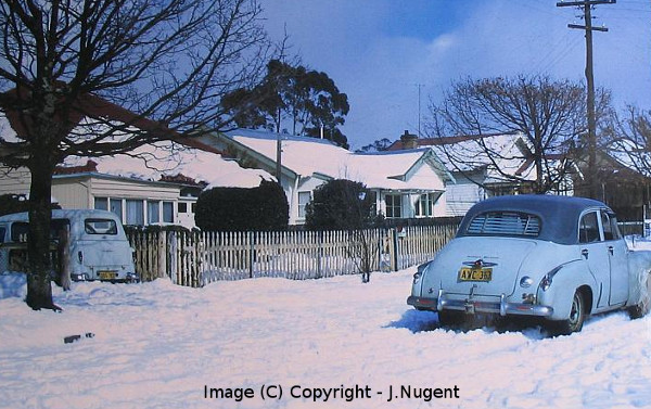
Well, what a snow event this was, especially for the Blue Mountains and places like Goulburn and even Canberra - even though the BoM didn't forecast snow for the Blue Mountains, at all. Well, at 6:20am on Tuesday they did, after most of it had fallen. By 3am Tuesday, I was unable to go back to sleep, as I could hear the transition from rain to sleet to snow, occuring on my roof. As soon as I opened the door, then noticed heavier showers approaching on radar, well, no sleep was had after that. Blackheath had about 6cm of snow on the ground by 7am and Katoomba had 6cm to 7cm. Hartley, at around 800M, also had a good settling to a few cm. Light, settled snow was also observed in Leura.
There wasn't much talk of snow officially from the BoM, except for an initial mention of snow above 1200M, a few days before the event. This concerned a number of weather enthusiasts, as there were indications in the models of a low level cold pool, undercutting a moist layer in the middle atmosphere. Due to the coldness of the change that moved up the coast in a summer-like pattern on Monday afternoon (in the form of a SE change influenced by a surface high to the south) we had an isothermal layer develop from about 900hPa (the approximate altitude of Blackheath) up to a few kilometres above Blackheath. That is, the atmosphere from about Blackheath to 2km to 3km above Blackheath had a uniform temperature profile - the temperature was effectively the same all the way up. Colder surface air than usual air across the Blue Mountains, allowed snow falling from higher up, to mostly remain unmelted and able to settle nicely above about 800M to 900M - depending where this lower level cold pool was most cold/optimal.
So, as moisture laden air in the mid levels overlayed similarly (and unusually) cold air in the lower levels, we had a situation primed for snow, in this instance. Add to that, moderately heavy showers observed on radar in the Blue Mountains, encouraged the process of latent heat absorption (as snow melted slightly) in the lower levels, which brought about an increased cooling of the lower atmosphere, which gradually lowered the temperature from about 2C to 0C in Blackheath and other areas.
Therefore, the typical cold air convection guideliness that are often used to predict good snow producing clouds (temperature at 500hPa, temperature at 850hPa etc) didn't apply in this case and perhaps the BoM and others forgot to consider this. The weather balloon information from Sydney on Tuesday morning showed it was about 1C at 850hPa, -4C at 700hPa and only -20C at 500hPa - hardly cold enough, typically, for good snow clouds to form and for snow to settle in our region. Unless, that is, you considered the cold pool at 900hPa, which was cold enough to allow for snow to fall and settle - just.
So to summarise, a summer-like southerly change pattern, brought cold air along the coast on Monday night, which spread toward the Blue Mountains by very early Tuesday. Being mid September, this lower level air was colder than your typical summer change and set up a nice scenario for snow, as the moist air in the mid levels above it, produced good shower activity. As the heavier showers fell into the quite cold lower level air over the mountains, latent heat absorption as the snow melted slightly, subsequently cooled the lower atmosphere even more, so falling snow that would usually melt away in September, remained 'alive' and settled beautifully across upper mountains towns.
NB: I'm not interested in any finger pointing exercises or unkind criticism but folk across the Blue Mountains do need the BoM to produce a clearer forecast during potential snow events, such as this. It was very evident that snow was at least a moderate chance during this system and its unclear why it wasn't included in the official forecasts, until the forecast was updated at 6:20am on Tuesday - after most of the snow had fallen.
September 8th and 9th, 2019
This event was not a notable snow event this far north but it brought some light snow to Sunny Corner (a dusting) and also, I imagine, some light settling to Shooters Hill on the Oberon Plateau. Sadly, it also brought with it some damaging winds with huge trees crashing onto homes in Blackheath. For many years now, it has been observed that the 'Megalong Gully' west of town and east of the Shipley Plateau, funnels strong winds directly into town and enhances their strength. Whilst our top wind speed from this event was 92km/r hour from the official Mt Boyce AWS, the wind damage in some streets seemed more like a result of winds beyond 110km/r. Laurier Williams from Australian Weather News has made some comments about this and I think its worth repeating here:
'It does need seriously strong wind to push over a tree and pull up the entire root ball. This happened to a number of even larger trees around my friends' property in Wills Lane in 2011 - the root balls were the size of a one-car garage.
If you look at the topography on this map (Google Maps) with Romaine Street pinned, you can see deep indentations into the N/S Katoomba-Mt Vic ridge straddled by the Shipley Plateau out to the W. The Centennial Glen indentation is 1km due west of Katoomba station, while the narrow Megalong Creek gully south of the narrow ridge linking to the Shipley Plateau opens out to the SW, funneling further winds enhanced by a strong gully effect into the main part of town. The combination of the two would, I believe, be maximised in a fluctuating W to WSW flow when strong gully effects would be operating form both indentations - as happened both yesterday and in 2011. Winds from the N of W would reduce up-gully winds in Megalong Creek. If you slide the map up to see Medlow Bath, where the row of huge pines was downed in 2011, you can see it is due E of the entrance to the Megalong Creek gully.'- Thanks, Laurier.
August 10th and 11th, 2019
What an event this was. As I get time I will add to this report with more information. Blackheath had snow showers developing from about 5am on the 10th and the temperature was just below zero at the time. By 6am, the snow had become heavier with moderately intense snow showers occuring for some hours. By 10am, we had around 7cm to 8cm on the ground in our part of town. This varied somewhat, which is the nature of snow showers - and parts of town well to the east got around 3cm or so. Katoomba had nice snow showers and there was even reports of a few flurries at Lawson. Lithgow had a good cover, similar to Blackheath and the Oberon Plateau had perhaps 30cm in places.
The view on Sunday across to the Oberon Plateau from Blackheath was amazing with so much good snow cover. Sunday the 11th had more snow showers commencing at around 7am and they continued for some time, giving us a depth of 3.5cm by mid morning. The atmosphere was quite cold for this event, with the Sydney Sunday sounding showing -30C at 500hPa, -10C at 700hPa and around -2C at 850hPa. This allowed for lovely, drier snow, compared to the snow we had on June the 4th, which was very slushy and wet. On both the 10th and 11th, our maximum was 2.5C, which appears to be a site record, going back 26 years. -1C on Saturday was our minimum and -0.6C was our minimum on Sunday. Then, more light snow showers came in during late Sunday night and remained by daybreak on Monday, so that gave us snow on the ground on three consecutive mornings. A rare event in the twenty first century. I'll add more to this report as time allows. Head to the photos link above to see our snow images.
July 13th, 2019
A brief little fall rushed across the Oberon Plateau on the 13th of July. The system was quite stable so not much shower activity eventuated. Still, there was enough for snow to settle at Shooters Hill to maybe a few cm at best by midday. Oberon township had snow showers, too. Blackheath had snow showers at around 7am that ebbed and flowed for about an hour. It was wet snow as the temperature was always above zero in the 1C to 2C range.
June, 4th 2019
What a lovely little fall this was. For about a week leading up to this event, most weather watchers were enthusiastic about the possibility of an East Coast Low developing in the Taman Sea, off the coast of NSW. However, I don't think many of us expected snow to fall at quite low levels, including Goulburn and even briefly in Mittagong. There were also flurries of snow at Bullaburra and perhaps lower. Blackheath ended up with around 5cm, as did Katoomba and Lithgow had a similar amount. And the Oberon Plateau had up to 15cm above 1200M. Whilst this was a very fun fall, relative to snowfalls in decades past (from the 1800s to about the 1980s) it was a small fall. Back in those decades, the Oberon Plateau could be closed for days, even a week, during the heaviest falls, with drifts metres high. The warming climate has changed our frontal patterns a great deal.
Snow started by around 4am on Tuesday the 4th. From 3am to 4am, it was initially sleet and cold rain. As the melting effect of snow in relatively warmer layers above the surface cooled the lower atmosphere, we were able to see snow at lower levels than officially forecast. Katoomba had about 5cm on the ground by daybreak and so did Blackheath, although the Blackheath snow was heavier in the area surrounding the oval and places nearby. Further to the east it dropped off to about 1cm to 2cm of cover. The temperature, even with the assistance of the 'melting effect' was marginal for good settled snow and this appears to be why areas that were slightly lower missed out on a good settling. Also, its the nature of shower activity to be hit and miss, like spring and summer showers are.
Here's an excerpt from a NZ Met Service blog on the melting effect and how it can cool the lower atmosphere. 'Snow starts melting once it falls below the freezing level but the melting process draws heat from the surrounding air, which lowers its temperature; thus, the melting snow drags the freezing level down with it, at least for a while. How far the freezing level within the area of falling snow is dragged towards the ground depends mostly on the intensity of the snowfall and the vertical variation of temperature and humidity of the air it is falling into.'
So, a nice event for June in the 21st Century. I have a feeling we may see more snow this winter. Fingers crossed. NB: I may add more information to this report as time permits. Feel free to email me with more info or thoughts, if you are keen at: blackheathweather@hotmail.com
May, 27th 2019
Well, that was a good little system for May in the 21st century. Not amazing by any stretch of the imagination and certainly nothing like the May 27/28 system in year 2000. The Wagga Wagga weather balloon information gave us the readings of -26C at 500hPa, -10C at 700hPa and -2C at 850hPa. For those new to the weather balloon data, those pressure points in the atmosphere indicate to us how cold and unstable the airmass (potentially) is. Imagine yourself starting off at the altitude of Blackheath (approx. 900hPa) and flying upwards through the layers from 850hPa (typically, a few hundred metres higher than Blackheath) then up to 700hPa, then even higher up to 500hPa. That's what the weather balloon does. It collects data as it floats into the atmosphere. Temperature at the different pressure points are recorded, as well as the relative humidity, wind speed and more. This gives us an idea of how primed the atmosphere is for rain, snow or storms etc.
Snow started by mid morning on the Oberon Plateau and soon started settling before midday. Accumulations out that way have not been large but it seems a few cm has fallen above 1200M. Blackheath started to see sleet by midday and then full on snow by 1pm. It settled a little but the temperature always stayed above zero and the snow shower activity was never strong. Just enough to look very pretty as it blew around in the wind. There is a local myth that too much wind stops snow from settling but that isn't true. I've seen 10cm to 15cm of snow settle in Blackheath during 100km/r winds and just as much settle in calm conditions. Its not usually a feature of the wind that prevents snow settling, rather, its a feature of the lower atmosphere (not cold enough) and also at times, a lack of cold air instability.
So, a nice event for May in the twenty first century. Going back a few decades, we would have had nice settled snow from an event like that but its still lovely to see snow falling in May in any year.
May 10th, 2019
A fairly benign system for rainfall, cold and snow. Even the ski fields didn't pick up a lot of snow. The models were showing, some days out, that the low pressure system over southern NSW would become vertically stacked and not tilted with atmospheric height - for better instability and cold. Effectively, this put an end to overly cold temperatures and productive snow clouds, as the low weakened. Blackheath experienced driving sleet at around 5pm on Friday the 10th for about half an hour but as soon as the relatively shallow frontal band passed, it was back to windy and cold but mostly dry. The Oberon Plateau had some brief snow flakes amidst the sleet but nothing of note.
March 30th, 2019
Some light snow showers at Shooters Hill and Edith on the Oberon Plateau during Saturday afternoon and evening. The atmosphere became a little colder in the mid and upper levels than forecast, so it was just unstable and cold enough to produce some light snow showers. Even Blackheath had a reliable report of some hail and sleet on Saturday afternoon. It certainly wasn't a major system but it was nice to see a bit of wintry precipitation so early in the season. NB: A bit of early sleet and snow is no indication of the snow season or winter ahead. We still have to wait and see how that pans out. You will occasionally see snow and winter forecasts weeks (and even months) ahead of the winter season, although IMO, they are not worth taking into account. Each and every winter is fickle in Australia and even just a few strong cold fronts can make a good ski season and fun winter season in the Blue Mountains. The changing climate has made strong cold fronts less regular and less potent in the twenty first century but there is always the chance of something powerful and snowy arriving in our region - even if its less of a chance, these days. Fingers crossed something fun arrives in May/June, I'm quite sure (but, not certain) it will.